


Green River Area Development District (Southwest) PUMA, Kentucky
About
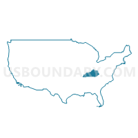
Outline
+PUMA%2c+Kentucky_A280.png)
Summary
| Unique Area Identifier | 192978 |
| Name | Green River Area Development District (Southwest) PUMA |
| State | Kentucky |
| Area (square miles) | 2,017.77 |
| Land Area (square miles) | 1,951.21 |
| Water Area (square miles) | 66.56 |
| % of Land Area | 96.70 |
| % of Water Area | 3.30 |
| Latitude of the Internal Point | 37.60102580 |
| Longtitude of the Internal Point | -87.40426430 |
Maps
+PUMA in Kentucky.png)
Graphs
Select a template below for downloading or customizing gragh for Green River Area Development District (Southwest) PUMA, Kentucky
+PUMA%2c+Kentucky_T0.png)
+PUMA%2c+Kentucky_T1.png)
+PUMA%2c+Kentucky_T2.png)
+PUMA%2c+Kentucky_T3.png)
+PUMA%2c+Kentucky_T4.png)
+PUMA%2c+Kentucky_T5.png)
+PUMA%2c+Kentucky_T6.png)
+PUMA%2c+Kentucky_T7.png)
+PUMA%2c+Kentucky.png)
Neighbors
Neighoring Public Use Microdata Area (by Name) Neighboring Public Use Microdata Area on the Map
- Barren River Area Development District (Outer) PUMA, KY
- Green River Area Development District (Northeast)--Daviess & Hancock Counties PUMA, KY
- Lincoln Trail Area Development District (West) PUMA, KY
- Pennyrile Area Development District (North) PUMA, KY
- South & Southeast Illinois PUMA, IL
- Vanderburgh County--Evansville City PUMA, IN
- Warrick, Gibson & Posey Counties PUMA, IN
Top 10 Neighboring County (by Population) Neighboring County on the Map
- Vanderburgh County, IN (179,703)
- Daviess County, KY (96,656)
- Warrick County, IN (59,689)
- Hopkins County, KY (46,920)
- Henderson County, KY (46,250)
- Muhlenberg County, KY (31,499)
- Posey County, IN (25,910)
- Grayson County, KY (25,746)
- Ohio County, KY (23,842)
- Breckinridge County, KY (20,059)
Top 10 Neighboring County Subdivision (by Population) Neighboring County Subdivision on the Map
- Knight township, Vanderburgh County, IN (67,945)
- Ohio township, Warrick County, IN (37,749)
- Pigeon township, Vanderburgh County, IN (29,799)
- Madisonville CCD, Hopkins County, KY (29,004)
- Whitesville-Philpot CCD, Daviess County, KY (25,918)
- Utica-Stanley CCD, Daviess County, KY (25,635)
- Perry township, Vanderburgh County, IN (25,092)
- Henderson CCD, Henderson County, KY (21,833)
- Spottsville CCD, Henderson County, KY (12,624)
- Black township, Posey County, IN (9,450)
Top 10 Neighboring Place (by Population) Neighboring Place on the Map
- Evansville city, IN (117,429)
- Henderson city, KY (28,757)
- Mount Vernon city, IN (6,687)
- Beaver Dam city, KY (3,409)
- Newburgh town, IN (3,325)
- Morganfield city, KY (3,285)
- Providence city, KY (3,193)
- Hartford city, KY (2,672)
- Breckinridge Center CDP, KY (2,080)
- Sturgis city, KY (1,898)
Top 10 Neighboring Unified School District (by Population) Neighboring Unified School District on the Map
- Evansville-Vanderburgh School Corporation, IN (179,703)
- Daviess County School District, KY (67,652)
- Warrick County School Corporation, IN (59,689)
- Henderson County School District, KY (46,250)
- Hopkins County School District, KY (44,301)
- Muhlenberg County School District, KY (31,499)
- Grayson County School District, KY (25,746)
- Ohio County School District, KY (23,842)
- Breckinridge County School District, KY (18,642)
- Mount Vernon Metropolitan School District, IN (15,903)
Top 10 Neighboring State Legislative District Lower Chamber (by Population) Neighboring State Legislative District Lower Chamber on the Map
- State House District 118, IL (99,068)
- State House District 78, IN (77,639)
- State House District 76, IN (59,647)
- State House District 77, IN (58,132)
- State House District 14, KY (45,708)
- State House District 18, KY (43,650)
- State House District 17, KY (42,990)
- State House District 7, KY (39,972)
- State House District 11, KY (39,906)
- State House District 4, KY (39,505)
Top 10 Neighboring State Legislative District Upper Chamber (by Population) Neighboring State Legislative District Upper Chamber on the Map
- State Senate District 59, IL (209,843)
- State Senate District 50, IN (139,117)
- State Senate District 32, KY (126,482)
- State Senate District 5, KY (115,364)
- State Senate District 49, IN (113,960)
- State Senate District 4, KY (106,696)
- State Senate District 8, KY (106,187)
- State Senate District 6, KY (102,261)
Top 10 Neighboring 111th Congressional District (by Population) Neighboring 111th Congressional District on the Map
- Congressional District 2, KY (760,032)
- Congressional District 8, IN (694,398)
- Congressional District 1, KY (686,989)
- Congressional District 15, IL (681,580)
- Congressional District 19, IL (672,930)
Top 10 Neighboring Census Tract (by Population) Neighboring Census Tract on the Map
- Census Tract 9602, Muhlenberg County, KY (7,434)
- Census Tract 209, Henderson County, KY (7,314)
- Census Tract 305, Warrick County, IN (7,204)
- Census Tract 9205, Ohio County, KY (7,087)
- Census Tract 308, Warrick County, IN (6,749)
- Census Tract 207.02, Henderson County, KY (6,633)
- Census Tract 104.03, Vanderburgh County, IN (6,478)
- Census Tract 206.01, Henderson County, KY (6,454)
- Census Tract 18, Daviess County, KY (6,244)
- Census Tract 207.01, Henderson County, KY (5,908)
Top 10 Neighboring 5-Digit ZIP Code Tabulation Area (by Population) Neighboring 5-Digit ZIP Code Tabulation Area on the Map
- 42301, KY (42,440)
- 42420, KY (38,192)
- 47630, IN (34,423)
- 47715, IN (27,063)
- 42431, KY (26,916)
- 47712, IN (26,012)
- 47620, IN (13,427)
- 42445, KY (11,331)
- 47713, IN (11,032)
- 42261, KY (10,602)